
CoSail logoNavCoSail
Navigation program for sailors

Real charts and navigation tools — in your pocket

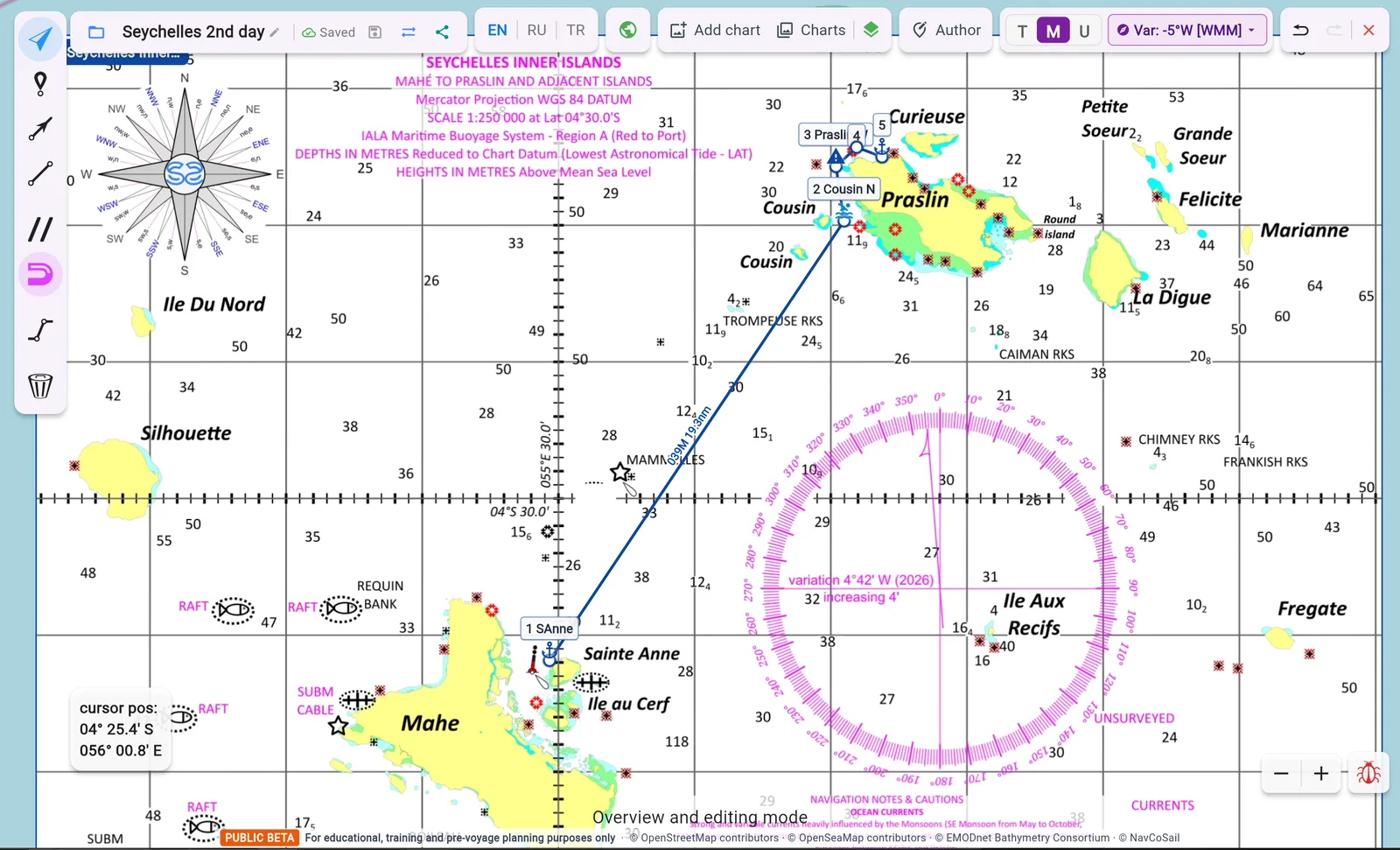
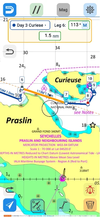
NavCoSail works in the browser on a computer and a smartphone: plotting, courses and distances, passage plan — nothing to install.
NavCoSail
NavCoSail — smartphone

What the program can do

From a quick sketch to a full passage plan — with the same tools on a computer and a phone.

A route in a few clicks
1

A route in a few clicks

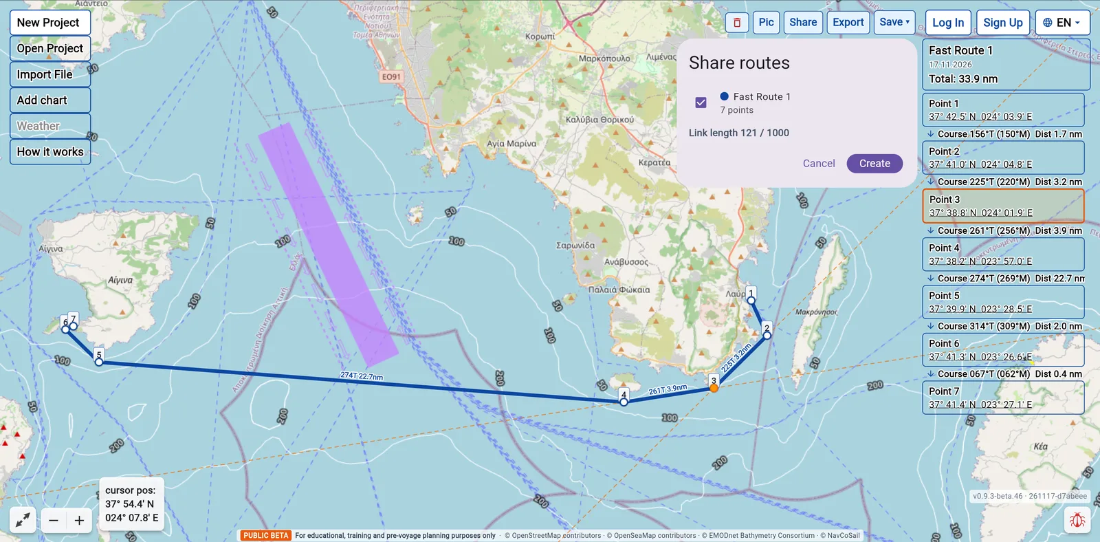
Sketch a route right on the start screen: waypoints, courses and distances appear at once. Nothing to set up.

Try it →
The full picture of the passage
2

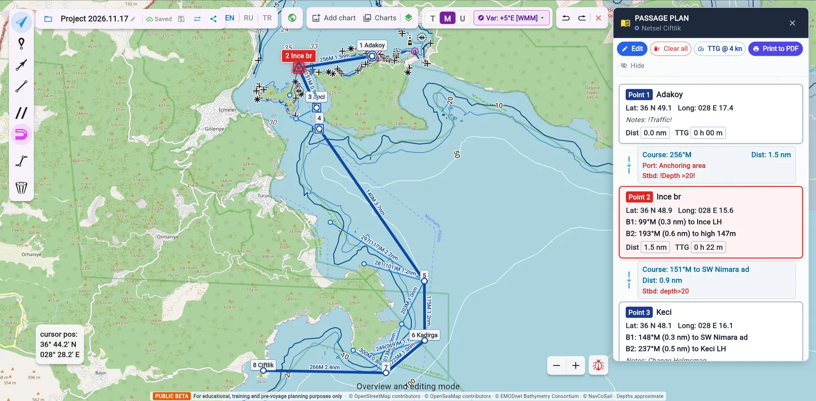
The full picture of the passage

Build a route with turning points, courses and time underway and put together a passage plan. Share it with the crew, transfer it to your chart plotter or follow it from your smartphone in the mobile version of the app.

Plan a passage →
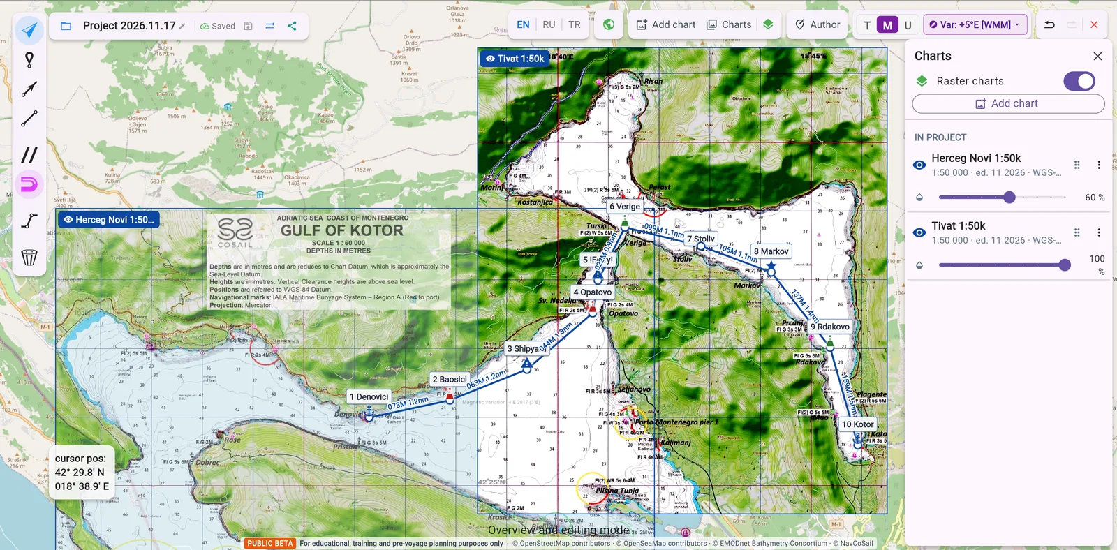
No subscription for the area?
3

No subscription for the area?

Photograph the paper chart from your chart table, tie it to the map by a few points — and work on it in the program just like on an electronic chart.

Add a chart →

Do you have a plan for the perfect week-long route?

Just put it on your page as a QR code! A guest points a phone camera at it — and the route opens in the program.

  1. 1Build the route
  2. 2Press “Share”
  3. 3Save the QR code and place it anywhere
QR code of a demo route in NavCoSail
Scan it — this is a real route
Open the route →
For schools and instructors

Teach reliable methods — in the new reality

Want to teach your students reliable navigation methods in the new reality? Use all the tools of the program. Below is a live training task — you can solve it right here.
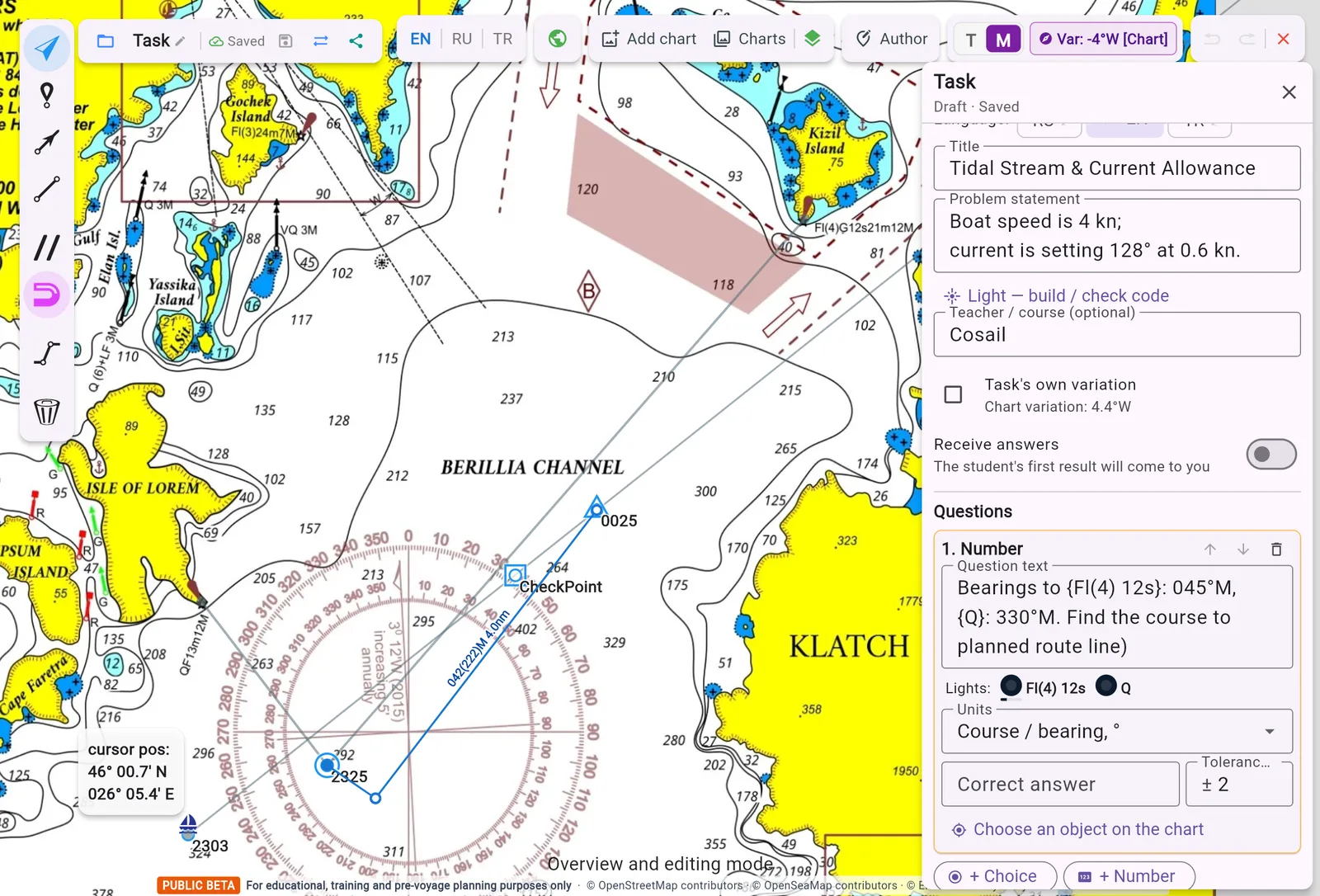
The program opens inside this window
↗ Open in a new tab

Any tasks

An instructor creates a task on the training chart: the text, the questions, the reference solution. The student solves it, the program checks the answers and sends the result to the instructor. A training chart for your school — on request.

Embed it in your website or learning platform — one line of code

<iframe src="https://nav.ru.cosail.org/?t=267ab7d6-38c1-42b2-88b5-4a90466756b9&embed=1" width="100%" height="640" allow="fullscreen; clipboard-write"></iframe>
Works in Moodle and any platform that accepts HTML; where only links are allowed, the task opens by link.

Cosail regattas and courses

Crew recruitment for the regattas is open. ISSA courses in Marmaris: theory and practice, from preparing the yacht to sailing on your own.

Schedule on alex-cosail.com →

Versions and what's new

The program keeps growing — here is what appeared recently.

  1. v0.9.3-beta.4617 Nov 2026
    • Training module for schools: an instructor creates a task on a training chart, a student solves it by link on a computer or a phone, the program checks the answers and sends the result to the instructor. Questions to the instructor right from the task; lighthouse lights flash in task texts with their real character.
  2. v0.9.3-beta.3615 Nov 2026
    • Our own vector chart layer: shorelines, piers, depth contours and soundings, seabed, buoys and beacons — visible to everyone, no sign-in needed.
  3. v0.9.3-beta.2712 Nov 2026
    • Paper charts in the app: photograph a chart, tie it to the map by its corners and a few points — and work on it like on an electronic chart. Charts travel with the project file.
  4. v0.9.3-beta.119 Nov 2026
    • Fast Route on the start screen, on a computer and a phone: sketch a route in a few clicks, see courses and distances, share it as a link or QR code, save it into a project.
  5. v0.9.3-beta.421 Oct 2026
    • Sign-in with Google or email. Everything works without an account too; registered users get a little more.
  6. v0.9.3-beta.118 Oct 2026
    • Detailed 10 and 20 m depth contours along the coast from Bodrum to Antalya and a shallow-water warning.